No sailing, but very comfortable on the boat.
Gray days with all of the fog and clouds.
We got into Parkers last night and grabbed a mooring ball. It was super easy because there was zero wind. Two ropes tied down the line to the cleats. Quiet night except for a steady drizzle. Took Mazu out to the bow a few times. She is just excited but won't go. The water is glass. I could imagine it as ice. I'd put on my skates, slide off the boat and skate to shore. This water is so smooth, like a mirror.
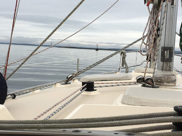
Going out of Red Brook Harbor there is a light house on a point, Wings Neck with a red and green traffic control light. You can just see the green light on the watch tower. Very New England. Air temperature is about 55 degrees. No more shorts and flip flops - now long pants, a sweater, jacket and sneakers.
The Cape Cod Canal can be very tricky because it has a 4 to 5 knot current that can boost the boat or cause terrible motion if going against it. Sailboats have to go with it. Drew read up in an old Eldridge information about the Canal and figured we needed to go on the "flood" tide that runs to the east from Buzzards Bay to Cape Cod Bay. Checking the times of the tides and currents he found it was best to leave early morning; 6:45 am.
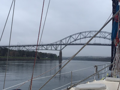
This railroad bridge is a lift bridge. It's mostly open but closes 2 to 4 times a day and no one can predict when except to say between 7 and 11 am and then in the afternoon between 3 and 6pm. It carries out the Cape Cod trash. During the summer there are a couple of passenger trains Friday - Sunday. We hoped to hit it right and luckily we did at 7:30 am.
Through the canal we hit 11.2 K zooming right through. We stopped at Sandwich Marina at the mouth of the east end for fuel. Instead of 2 hours at 6 knots it took a little over 1 hour at the increased speed.
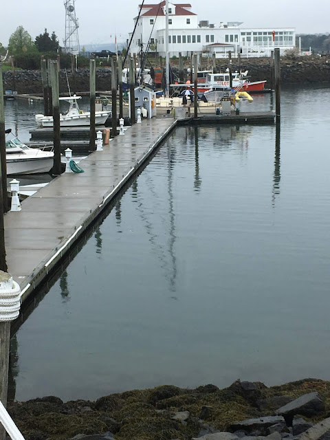
Here is the fuel dock and Shawnee tied up for a fill up. Note our yellow dinghy on the stern, "Tweety." I ran Mazu up the hill for a break. It was hard for her to choose to come back on board.
We scooted back into the current of the canal and headed east for Cape Cod Bay.
Out of the canal you can see we were able to just stay ahead of the rain. We're the blue dot heading toward Boston. (Took a picture of the weather app on my phone.)
Since Cape May, NJ we have noticed a ketch running parallel to us. Sometimes way out on the horizon, entering Block Island at Salt Pond just ahead of us, and now coming out of the canal at the same time. She is "Micky Finn," a 50 ' ketch and travels much faster, but somehow we've stayed together. Drew talked with him on the VHS radio and found out he's from Portsmouth, NH. Wish we could send him this picture. It's always hard to get a picture of your own boat. Today the sea melts into the steel blue sky like floating on air.
So sayonara til we "sail" again. Maybe sail into some sunsets that we haven't had lately with all the gray skies.
We sailed into our mooring in Marblehead Harbor on Thursday afternoon. In time for the champagne tasting at Shubie's we came aboard with delicious takeout salmon and treats for dinner with this final sunset.
Homw sweet home with Abbot Hall's spire sticking up on the horizon and not too many boats on their moorings yet. Happy day everyone. Thanks for traveling along with us. I'll blog the next time we head out for a real Marblehead sail.


1 comment:
Such a sunset to complete your journey and to welcome you home! especially after all those grey days. and congrats on staying ahead of the storms.
love,
Sara
Post a Comment