And we’re off…
Wednesday April 22 – Saturday April 24, 2016
After many days studying the Grib files (wind forecast app),
weather patterns coming this way on NOAA, weatherMaps+ and Buoy Data apps we
shoved off cleanly out of the slip. Deb
at the helm, Drew managing all the lines since we have 8 lines out from boat to
the dock and pilings. The weather sources
predicted 10 to 15 k winds, waves 3 to 5, clear skies and most importantly the
wind shifting around from the south instead of the constant northeast we’ve had
for months. We needed it to last for 3
days with the Gulf Stream giving us another 3 knots boost of speed.
So excited to leave
and get on the water.
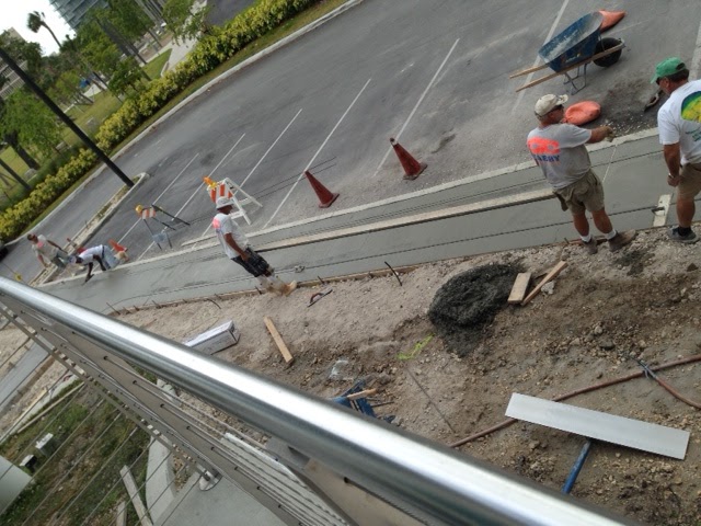
Going out past the working Miami docks. You cannot see the swells that are under the calm looking water.

Going out past the working Miami docks. You cannot see the swells that are under the calm looking water.

Well, wrong…the reality is 15 to 20 gusting 25 to 30, seas 4’
to 6’ to 8’ and lumpy. The weather guys
definitely made a poor prediction, definitely forgot to say a voyage only for
“salty sailors.” The rule to hold on
with 2 hands at all times does not mean we won’t get flung around the cabin and
cockpit (bruises to prove it – the telltale sign of a sailor v. powerboat owner.) When the reality is so different from the forecast
I always wonder why don’t the weather guys take a boat out and see what the
seas are doing. It’s like the weather people
at home giving an incorrect weather update. I want to scream, “Look out the
window!”
Deb at the helm through Fischers Island Cut and out through
the narrow Miami entrance/exit. Huge waves washed over the entire bow up to the
dodger as the bow sunk into the water.
Too violent to take pictures and steer. Shawnee would climb up a wave, get to the peak, and then slam down as
the wave moved through only to bury the bow again in the next wave. It slowed
us to 3.5 k speed. The waves were steep
with a tiny period between them. As soon
as we sailed beyond the stone jetty we turned left, and the seas were calmer.
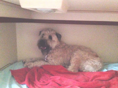
[Mazu was safe in the aft cabin on the bed, door closed panting and shivering,
her opus operandi for sailing trips. She stayed there most of the time.]

As we motor sailed on we soon realized these seas were not
going away even though the forecast said the wind would drop as we moved north
over the days. Thank goodness for my 3 +
day Transderm Patch—it’s a wonder that I can read and write anywhere on the
boat and not feel sick. Unfortunately
salty sailor Drew who gets through everything did get sick. It’s like a 3 day instant diet and exercise
routine when we sail “outside” i.e. on the open ocean. The option most sailors take is the route on the
Inter Coastal Waterway, ICW.
After saying for years
we don’t have adventures this time is our turn.
The waves banging over the bow knocked over our Dorade Vent, fortunately
attached with wire, and untied our dock lines so Drew went out to fix that. We both are wearing life jackets with tethers
attached to the jack lines whenever anyone goes out of the cockpit. We are wearing them all the time on this voyage
of waves over the sides. Jack lines run from bow to stern and are tied on
before the voyage.


With the boat
rocking and rolling Mazu decided she had to go and jumped out of the cockpit
onto the deck ready to walk to the bow.
I screamed for her to come back, and fortunately she felt the rocking
and had the good sense to turn around and jump back into the cockpit. After we put on Mazu’s life jacket and
tether, Drew walked her out to the bow so she could pee once. The rest of the time it’s been too rough to
venture out of the cockpit. I haven’t
gone out at all.
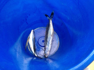
The first night
flying fish flew onto the deck and into the dinghy.
I am dying to go fishing and found a friend to set me up with the gear I need. It’s just too rough. Maybe I’ll try today. You can see the spool of line goes up to the blue clothespin that holds the line out of the boat. If there's a bite the line pops off the clothespin.


I am dying to go fishing and found a friend to set me up with the gear I need. It’s just too rough. Maybe I’ll try today. You can see the spool of line goes up to the blue clothespin that holds the line out of the boat. If there's a bite the line pops off the clothespin.

On the third night
as I was on watch something happened to the auto pilot and tracking
navigation. I looked at the navigation
instruments at the helm and saw a cross track error of 1.87 = almost 2 miles
off course. What should I do? Call Drew.
The wind also picked up. With the sails loud luffing, Drew took the helm
and steered us back on track as the waves were bumping me all over the cockpit. Following the captains orders I took in the
jib and most of the mainsail; not easy for a weakling cranking on the winches.
Drew later
explained that the strong wind on the sail and the wave action overcame the
autopilot. The nav system with the tracking
program, MaxSea, is not talking with the radar system to overlay the track or
route onto the radar screen.
Next, on the horizon
we kept seeing these flashes of light like a strobe or super bright lighthouse
from shore. You can guess – lightening. We stayed in front of it for quite a while,
but eventually the thunderstorm caught up with us and torrential rains fell,
cleaning off all the salt water. Nothing leaked except the dodger over the
companionway in spite of 3 layers of waterproofing – more will be added when it
dries out. I slept during most of the
storm and problems – not my watch. With
seas like these exhaustion quickly hits.
We can see the
squalls on the radar. They look like big,
amorphous, black blobs. After the
lightening, the navigation instruments are not working properly as the
autopilot cannot follow the track for some reason. The depth sounder stopped
working during this trip. Drew wasn’t
concerned – he said it will probably come back, it did.
Of course, we have
backups: paper charts, Navionics app on the ipad and Drew’s phone. I plotted a track on the Navionics app before
we left, and now, we are using it. No
backup for a depth sounder.
 Drew's phone with a close up and the Ipad with a large scale view. We are a red blob near the top.

We are down to eating
only what we can grab that won’t spill and won’t require us to stand for very
long in the galley: tuna fish salad, yogurt, cheese sticks, salami, ham,
instant oatmeal, drinks, carrot and celery sticks, crackers and almond butter,
popcorn, energy bars. I used to get
Stouffers meals to warm up but Drew doesn’t like them. I was hoping to do soup,
but too easy to spill.
Saturday, the last day of this voyage finally sees the
weather settle down. Beautiful day,
white puffy clouds.

Mazu comes out and is jumping up and down; tail wagging because she can walk without falling down or sliding across the floor. She climbed up to the cockpit and looks around, still not ready to go to the bathroom.

Mazu comes out and is jumping up and down; tail wagging because she can walk without falling down or sliding across the floor. She climbed up to the cockpit and looks around, still not ready to go to the bathroom.
As the day progressed we could see a large storm ahead. This is the entrance buoy to Beaufort Inlet Channel. It was too rough to take pix of the event.

When we hit the line in the water 38k velocity registered on the anemometer. 1’ to 2’ waves so we just plowed through the channel to get inside. The channel took an hour at 6k, no rain just amazing high winds. Tiny rainbow.

We anchored at 7:45 pm just inside the Beaufort Inlet.

We were the only boat in the anchorage next to the US Coast Guard station.

I slept until 11:30 Sunday.
We left Monday. For whatever reason we emptied the water from the fuel filter, racore oil water separator.
 4 tugs on the way.


When we hit the line in the water 38k velocity registered on the anemometer. 1’ to 2’ waves so we just plowed through the channel to get inside. The channel took an hour at 6k, no rain just amazing high winds. Tiny rainbow.

We anchored at 7:45 pm just inside the Beaufort Inlet.

We were the only boat in the anchorage next to the US Coast Guard station.

I slept until 11:30 Sunday.
We left Monday. For whatever reason we emptied the water from the fuel filter, racore oil water separator.